How to paddle the Mississippi River
Interested in paddling America’s great river from source to sea, or maybe a section of it? There are some really nice resources out there already (see below), but I will try to supplement them here. I kayaked the Mississippi solo in the fall of 2016, and it was the trip of a lifetime. It took me 62 days and over one million paddles to travel the 2100 miles of river on my route (~3500 km)! It was all beautiful, from northern lakes to river towns to bayous. I had a lot of backpacking experience, but not much paddling experience; it’s challenging but also very doable. Anyone with determination and proper preparation can do this trip, and I hope it continues to rise in popularity!
From conversations with the lockmasters at the lock-and-dams on the river, I estimate about 50 people do the Mississippi from source to sea every year. I encourage you to look into it if you’re interested. My main tips are to 1) do your research and 2) don’t skimp on safety.
Preparation
Key Resources
To start, here are some websites and others resources I found useful for this trip:
- An excellent blog by “Buck” who did the river in 2001. He has also answered a ton of questions people have had about the trip. This was my main source of information, and I referenced it throughout the trip: http://bucktrack.com/Canoeing_Down_the_Mississippi.html
- Another excellent blog by Christine, aka “German Tourist,” who did the trip in 2012: http://christine-on-big-trip.blogspot.de/search/label/Mississippi
- Another good account: https://backpackinglight.com/forums/topic/97345/
- An extremely comprehensive guide to the Lower Mississippi, south of St. Louis: http://www.rivergator.org/
- Mississippi River Paddlers Facebook group
- List of portages on the Mississippi River: http://www.mississippiriverresource.com/travel.html
- MAPS! Provided by the Minnesota DNR & Army Corps of Engineers for free:
- Headwaters: http://www.dnr.state.mn.us/watertrails/mississippiriver/index.html
- Upper Mississippi: http://www.mvr.usace.army.mil/Missions/Navigation/Navigation-Charts/Upper-Mississippi-River/
- And Lower Mississippi: http://www.mvm.usace.army.mil/Missions/Navigation/River-Navigation-Charts/
Background Information
The river begins in Minnesota, at Lake Itasca, and ends at the Gulf of Mexico, ~2300 miles later. It can be divided into three sections: Lake Itasca to Minneapolis, Minneapolis to St. Louis, and St. Louis to the Gulf. There are a number of portages on the first leg and it has some of the most wild sections, with only small towns and cities. The second section, MIN to STL, has ~30 lock-and-dams that you can go through, and you will encounter barges and industry, but it’s mostly still quite wild. The last section, from STL to the Gulf, has many barges and the river is quite isolated from cities. From beginning to end, I camped every night on islands, beaches, or in campgrounds. It’s incredibly wild, and if you’re going alone, you’d better like solitude in nature! I resupplied with food and water at least once per week in river towns. And although the current is faster during the last section, it’s not a float trip! Every day will be hard work, but it will be more than worth it.
Vocabulary (know these terms):
- Left bank descending and right bank descending: If headed downstream, the LBD is on the left, and the RBD is on the right.
- Wing dam: a dike of rocks made by the Army Corps of Engineers to channelize the flow, often just underwater
- Revetment: Reinforced rocky banks of the river that prevent erosion and speed up flow
- Barge: Technically one container in a “tow,” but can also refer to the whole thing
- Tow: All the barges being pushed by a towboat, can also refer to the whole thing
- Towboat: The boat pushing a tow
- VHF radio: A radio broadcasting on the set of frequencies reserved for marine traffic
- 9-foot channel: The channel in the middle of the river maintained to a depth of nine feet to allow barge navigation
- Wave train: The narrow ribbon of turbulence behind a barge that can extend almost a mile
- Mayday, pan, securite: Codes for for “need immediate help,” “urgent situation that could escalate to mayday,” and “safety message following,” respectively. Check radio manual for more details.

Necessary Skills
Almost anyone can do this trip. I was not a very experienced paddler when I started, but by the end I felt very confident in my kayaking ability. This trip is so long that you will improve a lot. But you need some basic skills to start off:
-
Endurance! This is a long journey.
-
Backpacking or “tripping” experience: This trip is essentially backpacking; I sometimes describe it as the Appalachian trail on water. I’d recommend doing a backpacking or paddling trip at least a week long before you decide to try this! That being said, I know people who would be able to do this trip without extensive prior wilderness experience.
-
Ability to “self-rescue” in case you capsize. For a kayaker, this means you should be able to “Eskimo roll” and I also recommend having a paddle float as backup. I never capsized, but came close a few times.
-
Good form. You should have good paddling form before you start. Since you’ll be paddling for most of the day, and will paddle over one million times over the course of the trip, any imperfections could cause problems. I think chronic pain from improper form is one of the biggest reasons why someone might not be able to finish the trip.
Dangers
The Mississippi is big and powerful. But you will be fine if you are prepared and observant. I encountered several main dangers on the river:
-
Weather. Be observant and use common sense. I recommend checking the weather forecast every night, especially the NOAA forecast on your VHF/weather radio. If the wind is over 15 or 20 miles per hour, it’s probably best to wait for it to calm down before getting on the water (at least stay very close to shore). Sometimes you can get caught in big waves, especially on windy days. And getting caught in a storm on the water is incredibly dangerous. If you hear lightning, get off the water. I encountered several massive storms, luckily all at night while I was camping. They had severe wind, heavy rain, and constant lighting strikes, often nearby (remember that a 5 second delay between lightning and thunder=1 mile away). Camp in a sheltered area, like a forest, if there’s a storm coming.
-
Barges (and other vessels). Below Minneapolis, you will start encountering barges. These are large rafts of containers being pushed by “towboats.” Technically, a barge is just one of these containers, but most people refer to the whole thing as a barge. I probably saw 500 over the course of the trip. They can vary in size, from one container (aka one barge) to a “tow” of 49 of them. They are so big that they have to stay in the “main channel.” The main channel is a channel maintained to a depth of 9ft by the Army Corps of Engineers and is bounded by buoys on either side. Green buoys denote the descending right, and red buoys are on the descending left. Note that sometimes buoys can come unmoored and drift off to misleading places. As a general rule, stay out of the main channel if possible. And certainly get well out of it when a barge is coming. Needless to say, be extremely careful around barges; they could crush you like it’s nothing, and it takes a long time for them to stop. At the same time, they are nothing to really be afraid of if you’re out of the channel. You can see them coming from miles away, and they are slow (5-15 mph, but they can accelerate surprising quickly from a stop)! A few important safety tips: 1) Always take the inside of a bend when passing a barge/when a barge passes you. 2) Never cross in front of a barge. 3) Note that they have a huge blind spot in front for a hundred feet directly in front of the “tow.” 4) Barges are on VHF radio channel 13 and will also monitor channel 16 (the hailing/emergency channel). 5) They can honk. One honk means “danger,” five honks means “immediate, urgent danger, get out of the way!” 6) Sometimes you will encounter barges parked on the side of the river. Stay away. 7) Always assume the barge can’t see you. It’s often true. Their radar only picks you up when a kayak’s “broadside;” when you’re facing towards or away from them, it doesn’t detect you. And with new navigation systems, it may be the case that barge captains might not be checking their radar anyway. And it can be extremely hard for them to see you if the sun is reflecting off the water, so be don’t approach barges from out of the sun. You have an extremely low profile and look like debris from their point of view.You will become very familiar with how barges behave; southbound barges will seek the fast water on the outside of bends, while northbound barges will seek the slow water on the inside of bends. I enjoyed seeing barges pass by. I rarely “pulled over” onto shore to let them pass, but it was sometimes necessary from a safety perspective in narrow stretches. Don’t be shy about contacting them on the radio if you want to make sure they can see you. They take kayaks and canoes seriously. I never had any big problems with wake from barges. It’s surprisingly weak. But big yachts and other “pleasure boats” can rarely be a problem. Face into the waves (not parallel to them). And barges do leave a “wave train” that can be up to a mile long. This is a narrow strip of very turbulent water that you should avoid (Haha I called it the “ribbon of death” before finding out it was called a wave train).
-
Submerged obstacles. Not a huge issue really, but going over barely submerged dikes and wing dams could be a problem, especially if you were to get stuck on one. They are mostly just annoying as they slow the speed of the current (like they’re supposed to).
Hazardous areas include:
- Sauk Rapids, above St. Cloud, MN can be dangerous! Scout ahead (there is a portage). There weren’t any other major rapids I encountered at high water levels.
- The upper St. Anthony Falls lock and dam is CLOSED for the foreseeable future. Do not approach. Long portage.
- Portage around Chain of Rocks in St. Louis! People have died there.
- At the Atchafalaya River exit from the Mississippi (~ LM mile 319), there are 3 large channels with massive concrete structures that control water flow from the Mississippi to the Atchafalaya. Do not enter these channels (the Army Corps of Engineers recommends staying near the opposite bank to avoid being sucked in). The lock for entry to the Atchafalaya is further downriver at LM mile 303.8.
- There could be other danger spots. Always check your maps for navigation hazards.
Safety notes
- I never took my lifejacket off. I had no problems with bridges or debris, and never encountered any whirlpools bigger than a foot or two across. Severe flooding could be an issue. I only encountered moderate flooding near Iowa and it was not a big problem. I didn’t encounter any dangers I felt were “unreasonable.”
- Health is also a concern. By the end of the trip, I had finger pain from gripping the paddle all day. I think it was tendonitis, and was mostly in the middle two fingers on each hand. I suspect it must have been caused by improper form in some way. Fortunately, the pain was only at night, after paddling, and it went away after I finished the trip. Not too terrible, but this kind of thing seems to be common among paddlers on long trips.
- Other minor issues that came up were occasional minor elbow pain, wrist pain, both probably from improper form (form is important)! Both went away quickly.
- You’ll get a lot of sun exposure, so wear long sleeves and/or sunscreen.
- Eat enough food. You’re burning a ton of calories. As a 23-year old male, I aimed for ~3000 per day and that seemed to work for me (no weight loss). As with any wilderness trip, it’d be possible to develop a vitamin deficiency as well. Maintain a balanced diet.
- People: try not to camp in duck-hunting wetland areas in the fall. And use common sense when landing in sketchy parts of towns. I often camped out in the open, but usually not if there was a chance I was on private land. Probably wouldn’t have been a big deal, but like Buck (from above links) says: Out of sight, out of mind.
- Finally, all of the above dangers will be less dangerous if you have a paddling partner doing the trip with you. I’d recommend it. If you go solo (like I did), you need to be especially careful. In general, be prepared to sacrifice miles for safety. For example, on an especially windy day in the Quad Cities, Iowa, I thought I couldn’t cross the river safely to get to the lock on the other side. So I got out and portaged three miles around the dam (to the nearest put-in) rather than risk a sketchy crossing.
Timing
I started on August 28th, 2 weeks later than I really wanted to. I got lucky with weather; average highs were in the 60s and 70s for most of the trip, and 80s in October in the south (including some near-record highs). During a cold year, starting on Aug 28th could be a bit late. To minimize chances of cold weather, I’d recommend starting in early to mid-August. It will be hot at times, but that’s much better than cold. One group started on September 30th and they said that was way too late (they still finished though). You could also make it a summer trip. Fewer people seem to do it in late spring, but that would probably work as well.
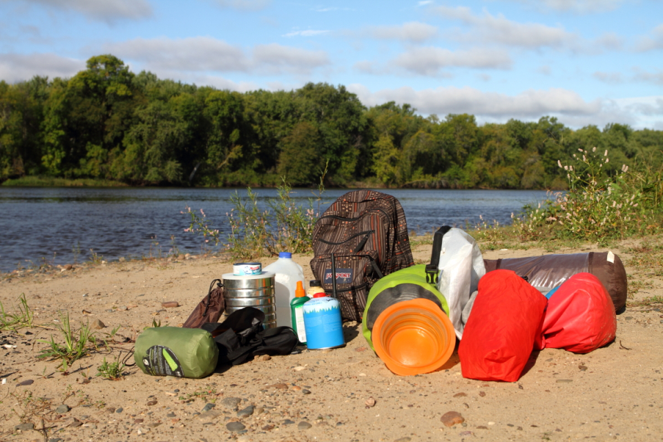
Gear List
This is what I brought.
-
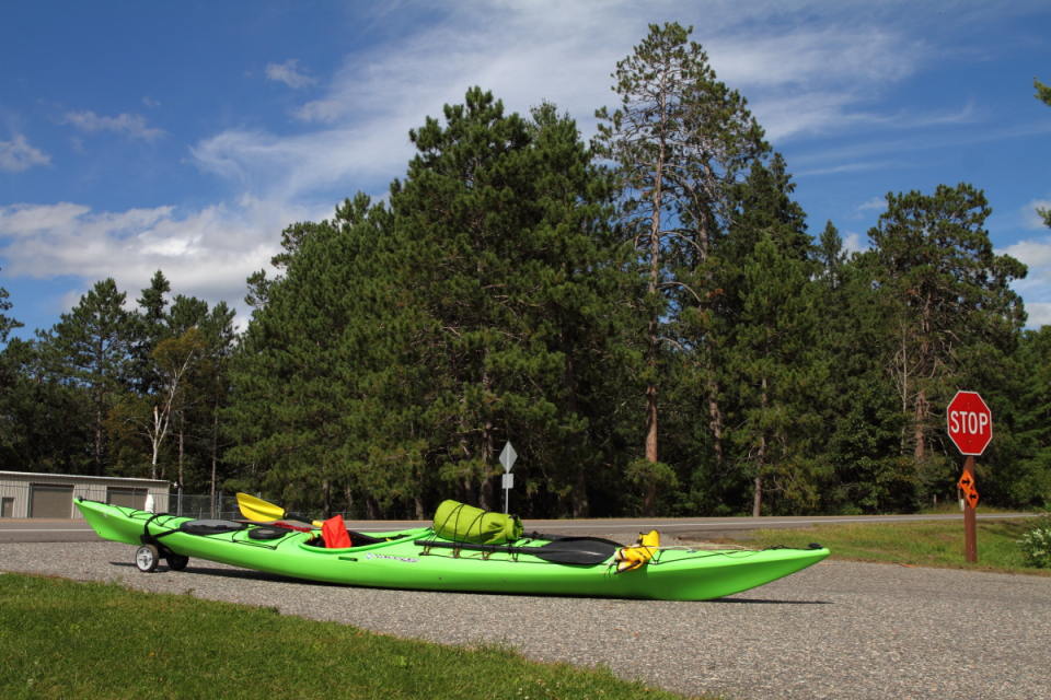
I had a Wilderness Systems Tempest 165 kayak (16.5 feet long). I highly recommend this boat, although I could have used more storage space, so maybe an 18-footer would have been better. Kayak or Canoe? It’s up to you – lots of people have done both. I chose a kayak because it isn’t as affected by the wind or capsizing. Canoes have a lot more storage space. If you go in a kayak, I recommend a sea kayak, and make sure you have a comfortable seat. I’ve also heard of people doing it with paddleboards…
-
Smartphone with a data plan. Makes everything easier.
-
phone battery back charger (I got a solar-powered one that I’d strap to the top of my kayak)
-
VHF Radio like this one. My radio was one of the most important items I brought. Many paddlers do not have them, but I highly recommend it. Once, a barge captain personally thanked me for having a radio. I talked to another barge captain as he disembarked from his barge (at a boat ramp), and he said it makes their jobs a lot easier. He also recommended announcing your presence when entering industrial areas with lots of traffic (something like: Green kayak headed southbound on descending right at St. Louis Arch, will be on channel 13). Read your radio manual for more info on how to use it, and how to hail other vessels. In general, don’t hesitate to call on radio if you think it might be the safe thing to do. Be short and professional and don’t clog up the airwaves. Monitor the station for ~30s before calling so you don’t interrupt an ongoing conversation. Radio was also my preferred method to contact lock-and-dams. Haha the lockmasters would sometimes even call me “captain” or “cap” over the radio, which was great.
-
Mosquito spray (and perhaps headnet)
-
Clothes (3 pair underwear, 1 pair shorts, 1 pair pants, 1 long-sleeved shirt, 1 short-sleeved shirt, 2 pair warm socks (I didn’t wear socks much))
-
Jacket/s (I brought a fleece and a “puffy,” but only really needed the fleece)
-
Rain jacket
-
Long johns
-
Wide-brimmed hat
-
Sleeping bag
-
Tent. I had an amazingly waterproof Alps Mountaineering 2-person tent that fit me nicely and kept me dry in some epic storms.
-
Inflatable pillow. Great luxury. Unfortunately mine got a hole.
-
Inflatable sleeping pad.
-
Drybags. I had one 20L that I put on top of my kayak, one 40L and 3 small ones.
-
Maps. I printed all the USACE maps and carried them with me in a drybag. I would get out the day’s maps and put them in my little drybag with my phone, notebook, etc.
-
Kayak/canoe
-
paddling gloves
-
Paddle and backup paddle
-
Paddle float
-
Paddle leash
-
Spray skirt
-
Bailer (I cut one out of half a ½ gallon milk carton; also useful for bathroom emergencies)
-
Bailing sponge (giant car wash sponges work great)
-
Life jacket!
-
Portage cart: absolutely necessary when doing it solo. There are some long portages, especially a 1.5 mile one in Minneapolis. You can make your own, but I bought one at REI.
-
at least 1 week’s worth of food at pretty much all times
-
day pack
-
Pocket rocket camp stove and isobutane fuel canisters (2 16oz canisters easily lasted me the whole trip), a couple lighters
-
sandals
-
camera
-
lock for your kayak/canoe. I made a lock from 7 feet of cable, 2 cable ferrules and a padlock, and used it to lock my kayak to a tree whenever I left it somewhere.
-
pocket-sized leatherman
-
cooking pot
-
knife, metal spork
-
towel, soap, shampoo (for rare showers)
-
other toiletries
-
Toilet paper, spade for digging catholes
-
compass
-
Sillcock key for getting water out of locked spigots. I had to use this only twice, but I’m very glad I had it on those occasions.
-
3 gallons water capacity (I started out with less, but didn’t want to stop much for water).
-
water filter for emergencies (like the sawyer system)
-
binoculars
-
paracord
-
duct tape
-
sunscreen
-
a couple books
-
first aid kit
-
bandana
-
Other: A spot locator to let people know where you are would be a great investment. More water capacity is always nice. I also wish I had the Sibley Guide to Trees with me. The water wasn’t cold enough for me to need rubber boots, like some trippers recommend in colder parts of the year.

The Trip
Mississippi River Birding Challenge!
I submitted around 200 eBird checklists for my trip on the river (eBird is a great community science website for birders), and I ended with 169 species. I believe this is the most seen on source-to-sea trip! But it is a very beatable total as well. If you are at all interested in birds, try keeping track of the number of species you see! Also try keeping track of the number of Bald eagles you see. I had 432.
Food and water
Getting food and water isn’t difficult. There are many towns along the river. I typically stopped once per week for groceries. This sometimes meant walking a long distance though, so plan ahead accordingly. I was sometimes offered rides back to the water by kind drivers, especially once they see that you’re carrying groceries! Towns become less frequent south of St. Louis so you’ll have to go longer between resupplies. I was able to get water at city parks, campgrounds, and water fountains for the whole trip (see my list of water stops at the end). I started with ~2 gallon water capacity and increased that to 3.5 gallons by the end so I had to stop less.
How to Camp
Camping on the Mississippi was one of the best things about the trip. You will see fantastic sunrises and sunsets and lots of cool wildlife. I found a nice campsite maybe 90% of the time. Sometimes trains are loud, but it didn’t bother me too much. I even found the gentle rumble of barge engines to be very relaxing. During the first section, from Lake Itasca to Minneapolis, the Minnesota Department of Natural Resources maintains excellent campgrounds for paddlers (a few are bad, but I won’t complain much since they’re free). I only needed to stay on islands a couple times during this stretch. From Minneapolis to St. Louis, I stayed almost exclusively on islands. This is really fun, but sometimes you might get forced to camp in a bumpy or vegetated spot. From St. Louis to the Gulf, camping is wonderful, at least at the medium river level it was at for my trip. Huge sandy expanses perfect for camping can be found on the inside of almost every bend. I was rarely worried about trespassing. As far as I can tell, nobody lives on or owns any of the islands in the Mississippi away from major cities. Land on the banks can be private, but you’re probably fine on the beaches and sandbars of the lower Mississippi. I never stayed at a hotel, but it’s definitely possible.
One very important thing while camping is to Leave No Trace. I was very disappointed to find many of the Minnesota DNR campsites had garbage strewn everywhere. And please dig catholes for waste. Bury or pack out toilet paper. Don’t burn garbage; pack it out.
Day-to-day schedule
I typically woke up at ~6, watched the sunrise, made breakfast, and was on the river by 7:30. Sometimes I slept in later though! After doing a little birding on the water, I’d paddle for a couple of hours before taking a break and eating a snack around 10. After paddling a couple more hours, I’d eat lunch at ~12 or 1, sometimes stopping on shore, sometimes staying in my kayak. Then I’d paddle until maybe 3 or 4, take a break, eat a snack, and paddle until about 5:30. Then I’d set set up camp, eat dinner, watch sunset, read a book, check weather, etc. I’d usually be asleep by 9.
Wildlife & Wilderness
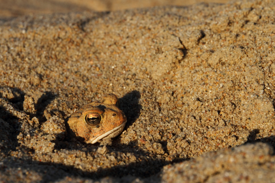
This is a wilderness trip; if it wasn’t a wilderness trip, I wouldn’t have done it. Being out there in nature is one of my passions, and that’s why I loved this journey so much. You do pass through cities and towns, but 90% of the river corridor is wild and wooded. I don’t think I saw a single farm from the river while paddling. I enjoy birding and saw some good species: A white-winged crossbill at the headwaters, a rare Sabine’s Gull on Lake Pepin in Minnesota, a Mississippi Kite in Wisconsin, a Sanderling in Kentucky, and owls hooting almost every night. Besides birds, I saw many mammals and herps: softshell turtles, alligators, beavers, a mink, otters, coyotes, a red fox, black morph gray squirrels, and a black bear! I also saw some interesting insects, like an Ant cricket (Myrmecophilidae) on a floating log, several phantom craneflies (Ptychopteridae) and my first American Rubyspot, a damselfy. I saw hundreds of migrating monarchs, and there were many other species of butterfly crossing the river, especially in the south. Other interesting plants and animals include: zebra mussels (invasive), tons of tiger beetles, a massive dead alligator gar, and larches. You don’t need to worry about alligators or snakes on the water. They are terrified of you, and I only saw 4 harmless water snakes (Nerodia sp.) the whole time. But do watch where you’re stepping on land; cottonmouths and copperheads are a possibility, although I didn’t see any. You’ll also probably encounter Asian carp. There are several species, and at least one of them likes to jump out of the water when they are startled. One even jumped directly into me, almost giving me a heart attack! They’re usually about 2 feet long and not something to worry about, but they are heavy and can definitely be surprising! This is a great opportunity to learn bird and plant identification; bring a field guide! Overall, the wildlife and the landscape was the best part of the trip for me. It was amazing to see the country change from spruce forest to willows and sycamores to cypresses across 15 degrees of latitude.
Other paddlers & community
I met one other long-distance paddler the whole trip, a nice guy named Aaron doing the Missouri+Mississippi (his website is adventureaaron.com). There aren’t a ton of people on the river at any one time, and we’re all moving in the same direction, so you aren’t going to catch up with many people. There is also a great, supportive community at the Mississippi River Paddlers facebook page, including “River Angels” that may offer lodging. I didn’t find out about this group until after I finished the trip, but I’m sure getting involved with them could make the trip more enjoyable, especially if you want some human company. One of the unexpected highlights of the trip was meeting some very nice and eclectic people on the river, like Stacey, a guy who carves willow branches into walking sticks and sells them on Craigslist for decent money!
What to do with your boat at night
It is extremely important that your canoe/kayak doesn’t float away, leaving you stranded. This has happened to at least a few people. Don’t let it happen to you. I was admittedly paranoid about this, and I dragged my kayak to the highest point near my tent every night and locked it to a tree. The most the river ever rose in one night for me was about a foot, but it can rise much higher much more quickly.
Lake Itasca to Minneapolis/St. Paul
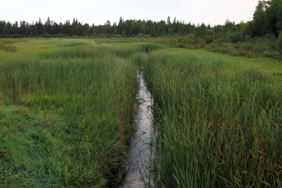
You begin at the source of the Mississippi in central Minnesota. The river then heads north, east then finally south, passing through several large lakes. If you’re lucky like I was, the river will be high, and you won’t have to drag your kayak along the rocky bottom. High water levels also mean you won’t get lost in the expansive marshes at the headwaters; the channel will be flowing and mostly clear. I’d still recommend google maps, the DNR maps, and a compass. In low water levels, you may have to start from Bemidji; call the Minnesota DNR for their advice. The lakes (Bemidji, Cass, and Winnibigoshish) can be really windy. You definitely should not attempt to cross Lake Winnie. Stay near shore. I encountered absolutely brutal winds and big waves. But most days were nice.
There are also 20+ portages along this section of river. See link #6 in the beginning. Some are a major pain; I remember four that are especially nasty – Little Falls, Blanchard, Sartell, and St. Cloud. The dam operators are apparently legally required to provide a portage path, but some of them have really skimped on it. I’ve read of at least one paddler that’s fallen and hurt themselves at the Blanchard dam portage. Some of them have stairs, which was a problem for me and my portage cart. The Minneapolis 1.5 mile portage isn’t really that bad except at the take-out spot, but it took me about an hour. I met two friendly guys there who helped me (thanks Bruce and Patrick)!
Camping is extremely pleasant (one of my favorite spots was Iron Bridge, before Bemidji), except Hassman. Don’t camp at Hassman. There are composting “throne” toilets at most sites. I did see a bear, so don’t keep food in your tent. From the headwaters to Brainerd is probably the wildest part of the river until you get to the deep south. You’ll see lots of wildlife and the fishing is probably great. Sandhill cranes bugle overhead, otters frolic and bob in the water, and Pileated woodpeckers are everywhere.
Minneapolis/St. Paul to St. Louis
This was the most difficult stretch for me, but it’s quite beautiful. Some new things include barges, lock-and-dams, and industry. I started to pass about one city per day. What makes it hard is that the 29 lock-and-dams create 29 “lakes” behind them, with slow current. I experienced some moderate flooding that sped it up to around 2 miles per hour (instead of 1 mph). I also encountered the most wind in this section. But it was very manageable overall.
Radio
You’ll probably want to start using your VHF radio more here. You will encounter barges, towboats crossing the channel, and some industrial areas, especially at St. Louis. Using it at Lock-and-dams gives you good practice. There are a few important channels: 16, 13, 14, and 9. All vessels with radios have to monitor channel 16, the hailing and emergency channel. 9 is an alternate hailing channel, especially for pleasure boats. 13 is what the barges use to communicate with each other and to announce their position. If I had my radio on, I’d typically be monitoring channel 13. Channel 14 is used for Lock-and-dams.
Lock-and-dams
I had a lot of fun going through lock-and-dams. They consist of a dam and a lock, which paddlers can go through (no charge). They cause enough water to pool behind them that the 9 foot channel can be maintained. Giant yellow paint markings denote the entrance to the lock, almost always on the far right or far left of the river. There are three ways to contact the dam to let them know you want to be locked through:
Pull the cord along the “long wall” (there will be a sign indicated it). Sometimes there will be a barge in the lock or waves will be strong and you won’t want to do this. Call via cell phone. I recommend having all the cell phone numbers in your phone before starting the trip. There were a couple times I didn’t have service. Calling on radio, on channel 14. This was my preferred method, but sometimes it was too windy for them to hear. It doesn’t have to be super formal; I’d usually say something like “Kayaker to Lock-and-dam 4” response: “Lock-and-dam 4.” my response: “Hi, I’m a southbound kayaker just above the long wall hoping to lock through. How’s it looking this morning?” When the gate is open and the light turns green, you can enter the lock. You’ll usually be given a rope to hold on to. They may sound a horn to let you know you are free to go. It’s nervous excitement as you go through your first one at Lock and Dam 1! It’s a huge drop. But the water level goes down slowly. The lockmasters are generally cool, and will sometimes come out and talk to you if it’s a slow day. Unfortunately, barges take up to two hours to go through the locks, so if you’re stuck behind one, you’ll have to wait. They get priority, but lockmasters will often let you go in between waiting barges. I never had to wait more than 2 hours.
I visited family in St. Louis and was able to leave my kayak at the Alton Marina. They were very nice and interested in the journey.

St. Louis to the Gulf of Mexico
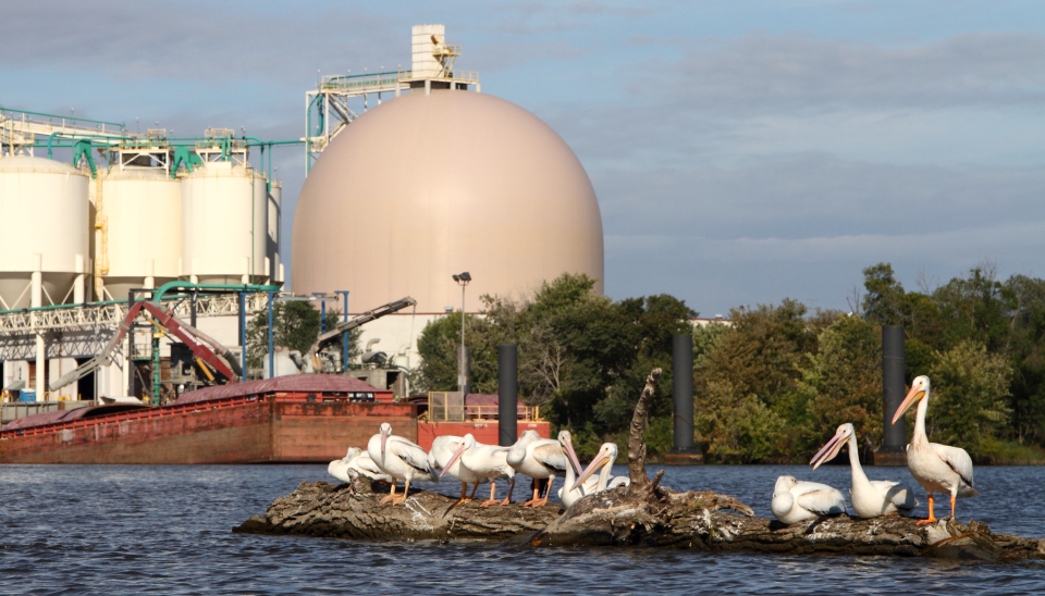
I enjoyed this stretch a lot. I only had one string of bad weather days with lots of wind, and the river starts changing. It’s also almost as wild as it was in northern Minnesota, with few towns on the river. You’ll start seeing lots of barges; 10-20/day. The confluence with the Ohio River has especially heavy barge traffic. Sandy beaches are everywhere, especially south of Tennessee, and temperatures were usually above 80 for me in October (warmer than usual though I think). Sandbars have huge numbers of pelicans, packs of coyotes howl at night, armadillos trundle through the undergrowth, and you may see some alligators as you get close to the Gulf. The river is big down here but not unmanageable. I actually expected it to be bigger! There are a surprising number of narrows, especially on the outside of large bends, where you might want to pull over to let barges pass.
I highly recommend going down the Old White River side channel as a change of pace.
Options at the end
There are two main ways that I know of to get to the Gulf from the Mississippi. You can take a distributary called the Atchafalaya River, or you can go out past Baton Rouge and New Orleans down to the small town of Venice. Rivergator.org convinced me to do the Atchafalaya, and I’m very glad I did. As John Ruskey puts it, it’s 150 miles of wilderness vs 300 miles of industry. The Atchafalaya is where the Mississippi would go if the Army Corps of Engineers didn’t force it to go past New Orleans, and is the only area in Louisiana where new land is being formed. The Atchafalaya basin is a vast, fairly pristine swampland. This was ideal for me because I wanted to be in wilderness more than I wanted to see New Orleans. At medium water levels, I experienced pretty good current and although camping wasn’t as good as on the Mississippi proper, I always made something work.
Judging from Google maps, it might also be possible to get to the gulf via Bayou Lafourche with a short portage in Donaldsonville, between Baton Rouge and New Orleans, but it looks pretty channelized and agricultural.

The Wax Lake Outlet
After going about 100 miles down the Atchafalaya, you can either continue to Morgan City and the Gulf that way, or you can go down the Wax Lake Outlet, which I did. The Wax Lake Outlet is a beautiful ~20 mile long canal that leads to the Wax Lake Delta at the Gulf of Mexico. I chose to do this to avoid industry in Morgan City and because I wanted to do a little exploration. I also took out at Burn’s Point park, ~10 miles west of the delta; if I had gone out the Atchafalaya, I would have had to paddle 20 miles upstream back up to Morgan City, which isn’t a big deal, but not something I was eager to do after finishing my trip. I really enjoyed going out this way.
To get to the Wax Lake Outlet, you can either go through Sixmile Lake (Yellow Bayou on Google maps) or you can take a “shortcut” off the Atchafalaya at mile 108.3 (See Google maps and Rivergator.org). I took the shortcut and it was excellent; a small channel with very fast flow and filled with birds and a few alligators. The Wax Lake Outlet itself took me about three hours, and was heavily forested with cypress and sycamore at the beginning, and transitioned to willow and chinese tallow by the end. You’ll cross the intracoastal waterway (watch for barges), which is interesting in itself. I was expecting sandy scrub when I got to the Gulf, but I instead found a massive freshwater wetland with forested islands! This is because all that fresh water makes the salinity very low. Don’t expect many seabirds! I saw a couple of brown pelicans, a willet, and royal and sandwich terns. No laughing gulls or sanderlings! The area around Wax Lake pass is fun to explore. One other option is to go out Hog Bayou to the Gulf and end up in Bayou Sale Bay near Burn’s Point Park! I chose to camp at the small campground on Camp Island, no fee. Apparently it can get crowded during duck-hunting season. The next day, I headed west to Burn’s Point Park (maybe nine miles). I was expecting waves, but it was a nice day, and felt just like being on the river.
The Louisiana DWF has a nice map of the delta here.
Sample journal entry
This is an entry from late in the trip that could give you an idea of what the average day is like:
Day 51 – October 18, 2016 – 46 miles – Old Town Bend to Smith Point
The first half of the day was everything that’s difficult about this trip, and the second half, from 14:00 on, was everything that’s great about it. The day ended with the traditional parade of barges, including one with a record-setting tow of 49 barges, and now, just after sunset, two coyote packs on opposite sides of the river try to outhowl each other. When I first got in my kayak at 8:00, I knew it was going to be a rough one. 15 mph winds and strong waves are never good to start since they usually get worse as the day goes on. Progress was slow, but oddly, it started it to calm @ 14:00 and was glassy smooth by 16:00. Beautiful. Had a flock of dabbling ducks, including 30 Northern Shovelers and 4 Northern Pintail, a family of raccoons – mom and 4 pups following – and it was apparently near-record highs in the upper 80s. Hard to see barges in the blinding sun and it’s reflection; you’d think you could never miss one but it’s very possible. Camped at Smith Point, across from the White River lock, on an extensive beach with shorebirds. The evening was so nice I sat and took it all in, including sunset and a passing barge, before setting up camp. Sometimes it’s just not an option to ignore it. Bean burritos for dinner. Excited to go down the Old White River side channel tomorrow! Also rescued a leaf-footed bug (Acanthocephala declivis) from the brown foam, and he took a ride with me for ~4 hours until I made landfill. Highlight: smooth paddling and the raccoon family.
Moments
Here are some moments, some good, some bad, that I will remember:
-Mayflies as a fine mist – Whirligigs dancing as I approach – squirrels fervently, but very slowly, swimming across the river – A Pileated woodpecker giving its wild, echoing rattle – Spray from the paddle on a hot day – Spray from the paddle and a shiver on a cold one – Mosquitoes descending as soon as you beach your boat – Nervous excitement going through the first lock – Otters grunting as they bob their heads above the water to look at you – Taking shelter behind a small island to avoid the blasting wind and waves for a moment – The bliss of a windless day – realizing that the monarchs are going further than you are – waking up to the sound of gunfire from a duck hunter with a blind only 30m away – Long streams of grackles that never seem to end – Sandhill cranes bugling in the mist – Getting to a lock just as a barge is leaving – Looking for camp and finding only islands with thick carpets of poison ivy – Yellow full moon rising – Memphis skyline at sunset – Soybeans floating in the water near a grain elevator – Seeing feathers floating against the sunset from a massive flying pelican flock – a big alligator enters the water with a loud splash as you get near – seeing that first gap in the trees, with the ocean just beyond

This is a trip that I will remember most for its natural beauty. Logistics were relatively straightforward, and everything went smoothly (having ample time to plan and do research was a key part of that). I never had any dangerous encounters, although there were a couple times where the adrenaline was pumping for a minute! Paddling the Mississippi is one of the best ways to explore America at “human speed.” What an epic journey. Get out there!
Tables and lists
Mileage (note that this was during a high water year in the headwaters, and with moderate flooding from Iowa to St. Louis. Flooding increases the speed of the current. Also note that these don’t include my “zero day” in St. Louis or the 9 miles along the Gulf to my pickup point. I went at a leisurely pace some days, and pushed myself on other days):
| Segment | Avg miles/day |
|---|---|
| Lake Itasca to Lake Winnie | 23 |
| Lake Winnie to Minneapolis/St. Paul | 32.5 |
| Minneapolis/St. Paul to St. Louis | 33.5 |
| St. Louis to the Gulf via the Atchafalaya | 43 |
| Total including zero day and start/end days (2109 miles) | 34 |
Drinking water stops. These might not be the best places to stop, but they are proof that you can get free clean water for the whole trip:
- Bemidji Visitor Center
- Campground at Knutson Dam portage (Cass Lake)
- Park at Lake Winnibigoshish dam
- Pokegama Dam (and FREE HOT SHOWERS and outlets)!
- Campground at Jacobson (fee for camping)
- Berglund Park in Palisade (+showers and outlets)!
- Park in Aitkin (+showers and outlets)!
- Kiwanis Park in Brainerd
- Sauk Rapids Municipal Park
- Brooklyn Park, MN River Park (83rd Ave N)
- Park/marina in Red Wing, MN
- Park in Wabasha, MN (+showers and outlets)!
- La Crosse, WI Riverside Park (not exactly paddler friendly access)
- Wyalusing SP, WI (a bit out of the way)
- Park at Guttenberg, IA (L&D no. 10)
- Park at Bellevue, IA
- Centennial Park in Davenport, IA
- City Park in Keokuk, IA (fee for camping, +water and outlets, no showers)
- Hannibal, MO
- Alton, IL marina
- Devil’s backbone campground, Grand Tower, IL (fee for camping, +water, showers, outlets)
- Caruthersville, MO Library (find a better place to get water)
- West Helena, AR random building with a spigot (sillcock key necessary)
- Warfield Point Park in Greenville, MS (fee for camping, +water, showers, outlets)
- RV Park in Vidalia, LA (if anyone’s around, ask nicely)
Electronic device charging stops:
- Berglund Park in Palisade
- Park in Aitkin, MN
- Library in Clearwater, MN
- Keokuk City Park, IA
- Warfield Point Park, Greenville, MS